
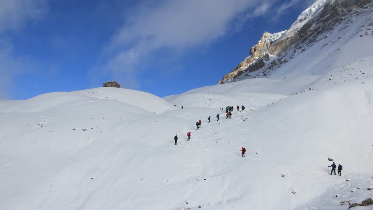
The Annapurna Circuit Trek itinerary takes you through one of Nepal’s most varied Himalayan trekking routes, crossing the dramatic Thorong La Pass at 5,416 meters before descending toward the sacred town of Muktinath and the dry landscapes of the Mustang region. The journey begins in the lower valleys of the Annapurna region and gradually climbs through Chame, Pisang, and Manang, where the landscape changes from lush forests and river valleys to high alpine terrain.
A typical Annapurna Circuit Trek takes around 12 to 16 days, depending on the starting point, transportation, acclimatization days, and how much of the traditional route you want to walk. The itinerary is designed around a gradual increase in altitude, with time in Manang helping trekkers prepare for the demanding crossing of Thorong La. After the pass, the trail drops significantly toward Muktinath and continues through the Kali Gandaki Valley, creating a striking contrast between the landscapes on either side of the circuit.
The exact Annapurna Circuit Trek itinerary can vary because road access has shortened some sections of the traditional route, while travelers may also choose to add destinations such as Tilicho Lake (4,919 meters) or allow additional time for acclimatization. A well-planned itinerary therefore balances walking distance, altitude gain, transportation, and rest rather than simply trying to complete the circuit in the fewest possible days. This guide outlines the main route, daily walking times, elevations, key stops, and practical itinerary options to help you plan the Annapurna Circuit with a realistic pace.
Annapurna Circuit Trek Itinerary at a Glance
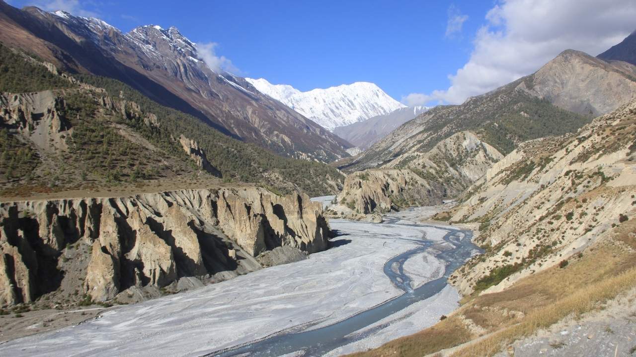
The Annapurna Circuit Trek follows a changing route from the lower valleys of the Annapurna region into the high-altitude Manang Valley, over Thorong La Pass (5,416 meters), and down through Muktinath and Mustang. The exact duration and starting point can vary with road access, transportation, acclimatization, and optional additions, so the table below provides a quick overview of the key itinerary details.
|
Trek Factor |
Details |
|
Trek Duration |
12 to 20 days, depending on route and transportation |
|
Starting Point |
Besisahar/ Dharapani area |
|
Ending Point |
Jomsom/ Tatopani / Pokhara |
|
Highest Point |
Thorong La Pass– 5,416 meters (17,769 feet) |
|
Main Highlight |
Crossing Thorong La Pass |
|
Trek Region |
Annapurna, Manang and Mustang |
|
Difficulty |
Moderate to challenging |
|
Best Seasons |
Spring (March to May) and autumn (September to November) |
|
Daily Walking Time |
Approximately 5 to 8 hours |
|
Accommodation |
Teahouses and mountain lodges |
|
Key Acclimatization Stop |
Manang– 3,540 meters |
|
Optional Extension |
Tilicho Lake– 4,919 meters |
Annapurna Circuit Trek Itinerary Outline
Before diving into the detailed Annapurna Circuit Trek itinerary, the outline below provides a day-by-day view of the complete journey. It covers the main destinations, elevations, trekking and driving distances, estimated travel times, and the key acclimatization point at Manang. The itinerary follows the classic route from the lower Marsyangdi Valley through Manang and across Thorong La Pass (5,416 meters), before descending to Muktinath and continuing through Jomsom, Tatopani, Ghorepani, and Poon Hill to Pokhara.
|
Day |
Annapurna Circuit Trek Itinerary Plan |
Elevation Profile |
Distance/ Duration |
|
01 |
Arrival at Kathmandu (1,400m/ 4,593ft) and hotel transfer |
|
|
|
02 |
Drive from Kathmandu to Syange (1,080m/ 3,543ft) via Besisahar (760m/ 2,493ft) |
640m/ 2,099ft (loss) |
Drive Distance: 200km/ 124 miles Drive Duration: 7 to 9 hours |
|
03 |
Trek from Syange to Dharapani (1,860m/ 6,102ft) |
780m/ 2,559ft (gain) |
Trek Distance: 14km/ 8.6 miles Trek Duration: 5 to 6 hours |
|
04 |
Dharapani to Chame (2,670m/ 8,759ft) trekking |
810m/ 2,657ft (gain) |
Trek Distance: 16km/ 9.94 miles Trek Duration: 5 to 6 hours |
|
05 |
Chame to Pisang (3,200m/ 10,498ft) |
530m/ 1,738ft (gain) |
Trek Distance: 14km/ 8.6 miles Trek Duration: 5 to 6 hours |
|
06 |
Pisang to Manang (3,519m/ 11,545ft) |
319m/ 1,046ft (gain) |
Trek Distance: 16km/ 9.9 miles Trek Duration: 5 to 6 hours |
|
07 |
Rest and acclimatization at Manang |
|
|
|
08 |
Manang to Yak Kharka (4,020m/ 13,188ft) |
501m/ 1,643ft (gain) |
Trek Distance: 11km/ 6.8 miles Trek Duration: 4 to 5 hours |
|
09 |
Trek from Yak Kharka to Thorong High Camp (4,540m/ 14,895ft) |
520m/ 1,706ft (gain) |
Trek Distance: 7.3km/ 4.5 miles Trek Duration: 4 to 5 hours |
|
10 |
Thorong High Camp to Muktinath (3,710m/ 12,171ft) via Thorong La Pass (5,416m/ 17,769ft) |
876m/ 2,874ft (gain) |
Trek Distance: 16.4km/ 10 miles Trek Duration: 7 to 8 hours |
|
11 |
Drive from Muktinath to Tatopani (1,190m/ 3,904ft) via Jomsom Bazaar (2,710m/ 8,891ft) |
2,520m/ 8,267ft (loss) |
Drive Distance: 72km/ 44 miles Drive Duration: 4 to 5 hours |
|
12 |
Tatopani to Ghorepani (2,874m/ 9,429ft) trekking |
1,684m/ 5,524ft (gain) |
Trek Distance: 17km/ 10 miles Trek Duration: 6 to 7 hours |
|
13 |
Morning hike to Poon Hill (3,210m/ 10,531ft) and trek down to Tikhedhunga (1,540m/ 5052ft) |
336m/ 1,102ft (gain) |
Trek Distance: 12.9km/ 8 miles Trek Duration: 5 hours |
|
14 |
Trek to Nayapul (1,070m/ 3,510ft) and drive to Pokhara (822m/ 2,696ft) |
718m/ 2,355ft (loss) |
Trek Distance: 9.8km/ 6 miles Trek Duration: 5 hours Drive Distance: 44km/ 27 miles Drive Duration: 1.5 to 2 hours |
|
15 |
Drive or fly back to Kathmandu (1,400m/ 4,593ft) and hotel transfer |
578m/ 1,896ft (gain) |
Drive Distance: 200km/ 124 miles Drive Duration: 6 to 8 hours |
|
16 |
International departure from Kathmandu to home country |
|
|
Annapurna Circuit Trek Detailed Itinerary
The 16-day Annapurna Circuit itinerary gradually moves from the lower Marsyangdi Valley into the high mountains, with Manang as the main acclimatization point and Thorong La (5,416 meters) as the highest crossing. The route then drops sharply into the Mustang side through Muktinath and Jomsom before climbing again toward Ghorepani and Poon Hill. Along the way, the trail takes you through distinct villages, monasteries, river valleys, forests, and high-altitude settlements, making the changing landscape one of the defining features of the circuit.
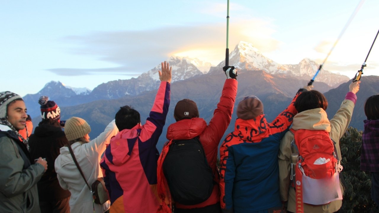
Day 1: Arrival in Kathmandu (1,400m/ 4,593ft)
Arrive in Kathmandu and transfer to your hotel. This is a preparation day rather than a trekking day, with time to meet your guide, check trekking equipment, and make final arrangements before heading toward the Annapurna region.
Day 2: Kathmandu to Syange (1,080m/ 3,543ft) via Besisahar (760m/ 2,493ft)
The journey to the trailhead begins with a 200 km drive taking around 7 to 9 hours. The route follows the Prithvi Highway toward the hill town of Dumre before turning north through Besisahar and into the Marsyangdi Valley. From Besisahar, the road continues through villages such as Bhoteodar, Khudi, Ngadi, Jagat, and Chamje before reaching Syange. The lower valley is characterized by terraced farmland, waterfalls, suspension bridges, and the fast-flowing Marsyangdi River.
Day 3: Syange to Dharapani (1,860m/ 6,102ft)
The first full trekking day covers approximately 14 km in 5 to 6 hours. From Syange, the trail follows the Marsyangdi River through Jagat and Chamje, then continues toward Tal, a broad settlement at the entrance to the Manang Valley. The route passes through pine and rhododendron forests, with waterfalls and steep valley walls becoming increasingly prominent before reaching Dharapani.
Day 4: Dharapani to Chame (2,670m/ 8,759ft)
The 16 km trek to Chame takes around 5 to 6 hours, passing through Bagarchhap, Danaque, Timang, and Koto. Bagarchhap introduces the Tibetan-influenced architecture and culture that become more noticeable as you climb higher. Around Timang, the valley opens to impressive views of Lamjung Himal and Annapurna II, while the trail continues through pine and fir forests toward Chame, the administrative center of Manang District.
Day 5: Chame to Pisang (3,200m/ 10,498ft)
From Chame, the trail follows the Marsyangdi Valley for approximately 14 km over 5 to 6 hours. The route passes through Bhratang, where the valley narrows between dramatic cliffs, before reaching Dhukure Pokhari and the settlement of Pisang. You begin to notice a major change in the environment as the forests thin and the mountains become more dominant, with Annapurna II and Pisang Peak providing prominent landmarks along the route.
Day 6: Pisang to Manang (3,519m/ 11,545ft)
The 16 km journey to Manang takes around 5 to 6 hours and offers two route options in parts of the valley. The higher trail through Upper Pisang, Ghyaru, and Ngawal is more demanding but rewards trekkers with expansive views of Annapurna II, III, IV, Gangapurna, and Tilicho Peak. Both routes eventually converge toward Mungji and Braga, where the historic Braga Monastery is an important cultural landmark, before reaching Manang.
Day 7: Acclimatization Day in Manang
Manang is the main acclimatization stop of the itinerary. Instead of gaining significant altitude, the day is used to explore the surrounding area and prepare for the higher trail ahead. A short hike toward Gangapurna Lake and the Gangapurna Glacier viewpoint provides useful acclimatization without adding another overnight at altitude. Manang itself is also worth exploring, with stone-built houses, narrow village lanes, monasteries, and views toward the surrounding peaks.
Day 8: Manang to Yak Kharka (4,020m/ 13,188ft)
The trail leaves Manang and enters increasingly high alpine terrain, covering around 11 km in 4 to 5 hours. It passes through Tengi and Gunsang before continuing toward Yak Kharka, with the vegetation becoming noticeably sparser above 4,000 meters. The route stays relatively short because altitude is now the main challenge; the goal is to gain elevation steadily rather than cover a long distance.
Day 9: Yak Kharka to Thorong High Camp (4,540m/ 14,895ft)
This is a short but important high-altitude day, covering approximately 7.3 km in 4 to 5 hours. The trail passes through Ledar and crosses the Marsyangdi Valley before climbing toward Thorong Phedi, the traditional staging point for the pass. Depending on the trekking plan and conditions, the night is spent at Thorong High Camp (4,540 meters), positioning you closer to Thorong La for the following morning's crossing.
Day 10: Thorong High Camp to Muktinath (3,710m/ 12,171ft) via Thorong La (5,416m/ 17,769ft)
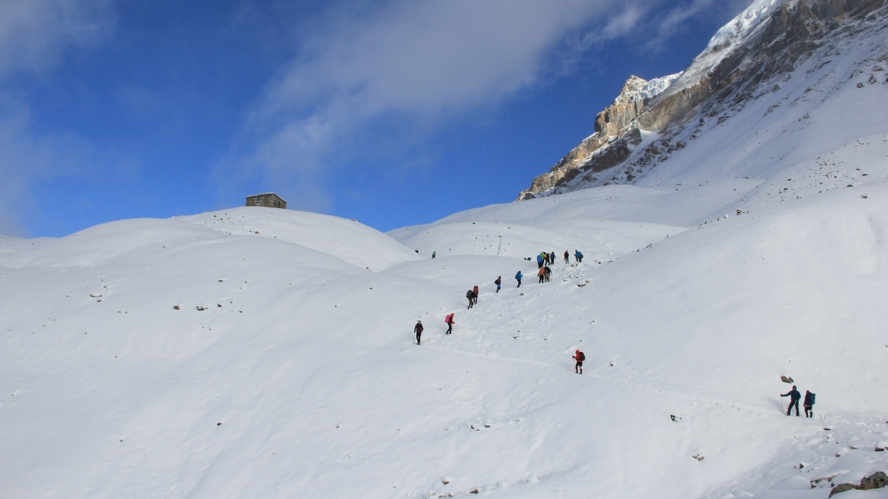
The most challenging day begins early with the climb toward Thorong La Pass at 5,416 meters, the highest point of the Annapurna Circuit. The ascent from the high camp is steep and demanding at altitude, but reaching the prayer flags and traditional pass markers provides a defining moment of the trek. From Thorong La, the trail descends for several hours toward Muktinath, covering approximately 16.4 km in 7 to 8 hours. Muktinath is one of Nepal's major pilgrimage sites, with the Muktinath Temple, 108 water spouts, and Jwala Mai Temple adding cultural significance to the end of this demanding day.
Day 11: Muktinath to Tatopani (1,190m/ 3,904ft) via Jomsom (2,710m/ 8,891ft)
After the Thorong La crossing, the itinerary shifts to road travel and drops more than 2,500 meters to Tatopani. The approximately 72 km drive takes 4 to 5 hours, passing through Kagbeni and Jomsom before continuing down the Kali Gandaki Valley. The landscape changes dramatically from the barren, high-altitude terrain around Muktinath to the warmer and greener surroundings of Tatopani, which is famous for its natural hot springs.
Day 12: Tatopani to Ghorepani (2,874m/ 9,429ft)
The trail climbs again, making this one of the more physically demanding lower-altitude trekking days. The 17 km route takes around 6 to 7 hours and passes through settlements including Shikha and Chitre before reaching Ghorepani. The scenery changes once again as the dry Kali Gandaki landscape gives way to dense rhododendron and subtropical forests. Ghorepani is also the base for the following morning's Poon Hill sunrise hike.
Day 13: Morning Hike to Poon Hill (3,210m/ 10,531ft) and Trek to Tikhedhunga (1,540m/ 5052ft)
An early morning hike leads to Poon Hill at 3,210 meters, one of the Annapurna region's best-known viewpoints, where clear weather can reveal a broad Himalayan panorama including Dhaulagiri, Annapurna South, Machhapuchhre, and Hiunchuli. After returning to Ghorepani for breakfast, continue downhill toward Ulleri and Tikhedhunga, completing approximately 12.9 km of trekking in around 5 hours.
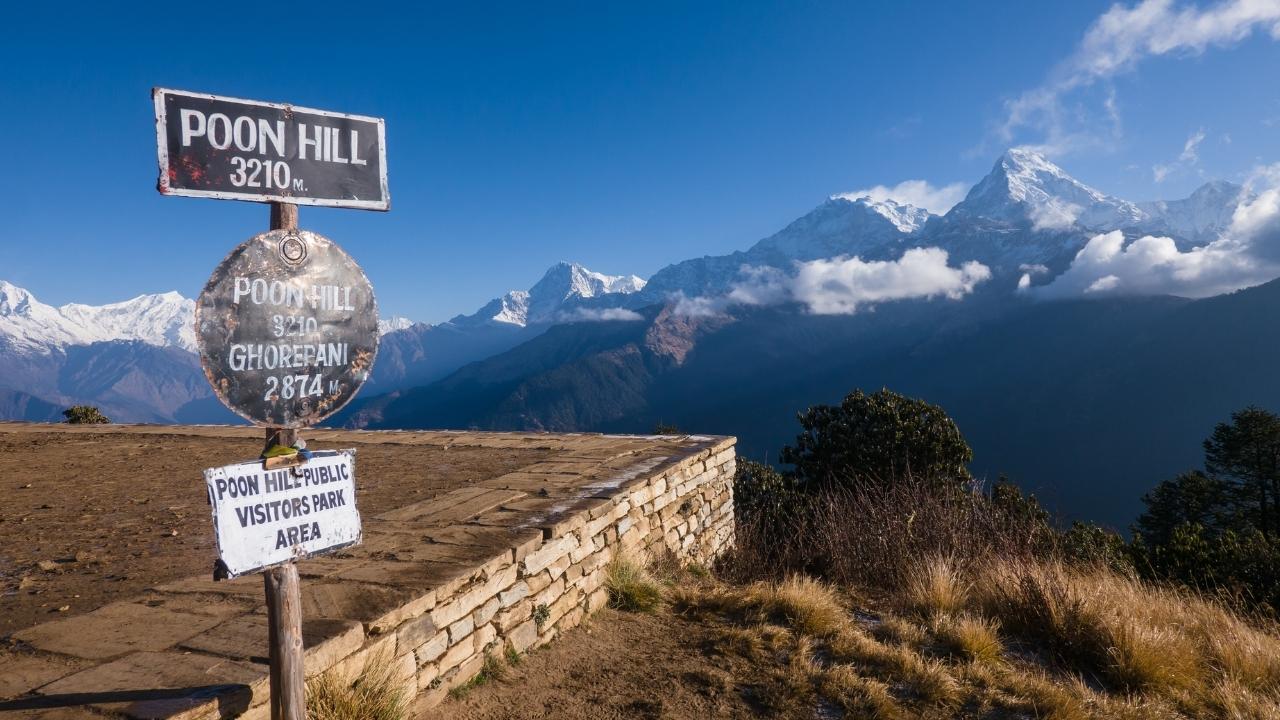
Day 14: Tikhedhunga to Nayapul (1,540m/ 5052ft) and Drive to Pokhara (822m/ 2,696ft)
The final trekking section descends through the lower hills toward Birethanti and Nayapul, covering approximately 9.8 km in 5 hours. From Nayapul, a 44 km drive of around 1.5 to 2 hours takes you to Pokhara. After days of walking through high mountain terrain, arriving beside Phewa Lake marks a clear transition from the trekking environment to the relaxed atmosphere of Pokhara.
Day 15: Pokhara to Kathmandu (1,400m/ 4,593ft)
Return to Kathmandu by road or flight. The overland journey covers approximately 200 km and takes 6 to 8 hours, following the Prithvi Highway through the middle hills. Flying is considerably quicker and provides an alternative when time is limited. On arrival, transfer to your Kathmandu hotel and spend the remainder of the day at leisure.
Day 16: International Departure
Your Annapurna Circuit journey concludes with your departure from Kathmandu. Depending on your flight schedule, there may be time for a final meal or last-minute shopping before your airport transfer.
Annapurna Circuit Trek Route Map
The Annapurna Circuit Trek route map shows how the journey winds around the Annapurna massif, beginning from the lower Marsyangdi Valley and gradually climbing toward the high settlements of Manang. From there, the trail continues through Yak Kharka and Thorong Phedi before crossing Thorong La Pass at 5,416 meters, the highest point of the circuit. The route then descends to Muktinath and follows the Kali Gandaki Valley through Jomsom and Tatopani before climbing again toward Ghorepani and Poon Hill.
The map also highlights how dramatically the Annapurna Circuit route changes in elevation and landscape. Major points shown include Besisahar, Dharapani, Chame, Pisang, Manang, Ledar, Thorong Phedi, Thorong La, Muktinath, Jomsom, Marpha, Tatopani, Ghorepani, Poon Hill, and Nayapul, with road connections shortening parts of the traditional circuit.
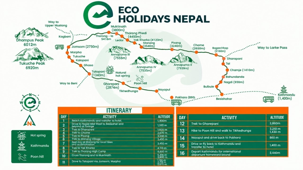
For the itinerary used by Eco Holidays Nepal, the route combines trekking and driving to create a practical 16-day Annapurna Circuit Trek. After reaching Muktinath following the Thorong La crossing, the journey continues by road to Tatopani, then returns to the trail toward Ghorepani and Poon Hill before ending in Pokhara.
Annapurna Circuit Trek Itinerary: Private vs Group Trek
The same Annapurna Circuit route can feel quite different depending on whether you travel on a private trek or as part of a group. The main difference is flexibility: a private trek allows the itinerary, walking pace, rest stops, and daily schedule to be adjusted around your group, while a group trek follows a more structured schedule shared by all participants. Your choice also affects the overall cost, particularly because guide, transportation, and other operating expenses can be shared among group members.
|
Feature |
Private Trek |
Group Trek |
|
Departure |
Flexible departure dates |
Usually follows a fixed departure |
|
Pace |
Adjustable to your group |
Follows the group's pace |
|
Cost |
Higher per person |
Generally lower per person |
|
Itinerary Changes |
Easier to arrange |
More limited |
|
Acclimatization |
Can be adjusted if needed |
Follows the planned schedule |
|
Walking Breaks |
Flexible |
Coordinated with the group |
|
Group Size |
Your family, friends, or selected travelers |
Shared with other trekkers |
|
Best For |
Families, couples, friends, and custom trips |
Solo travelers and budget-conscious trekkers |
A private Annapurna Circuit Trek offers greater flexibility: you choose the departure date, travel with your own group, and can adjust the pace, acclimatization days, or side trips. You can, for example, add Tilicho Lake (4,919 meters), spend extra time around Manang or Braga, or modify transport after Thorong La. It is especially suitable for families and friends.
A group trek follows a fixed itinerary and departure schedule, making it generally more affordable because guide and some transport costs are shared. The downside is less flexibility, but it suits solo travelers who enjoy meeting other trekkers and prefer a structured trip.
Which is better? Choose private for flexibility and customization; choose group for lower cost and social experience. Whichever you choose, don't compromise acclimatization to shorten the trek. The gradual ascent toward Thorong La (5,416 meters) is crucial, with the route planned around a realistic pace and proper acclimatization.