
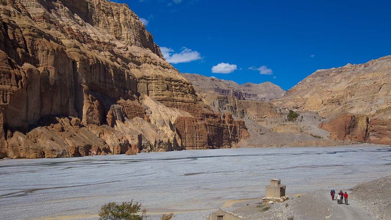
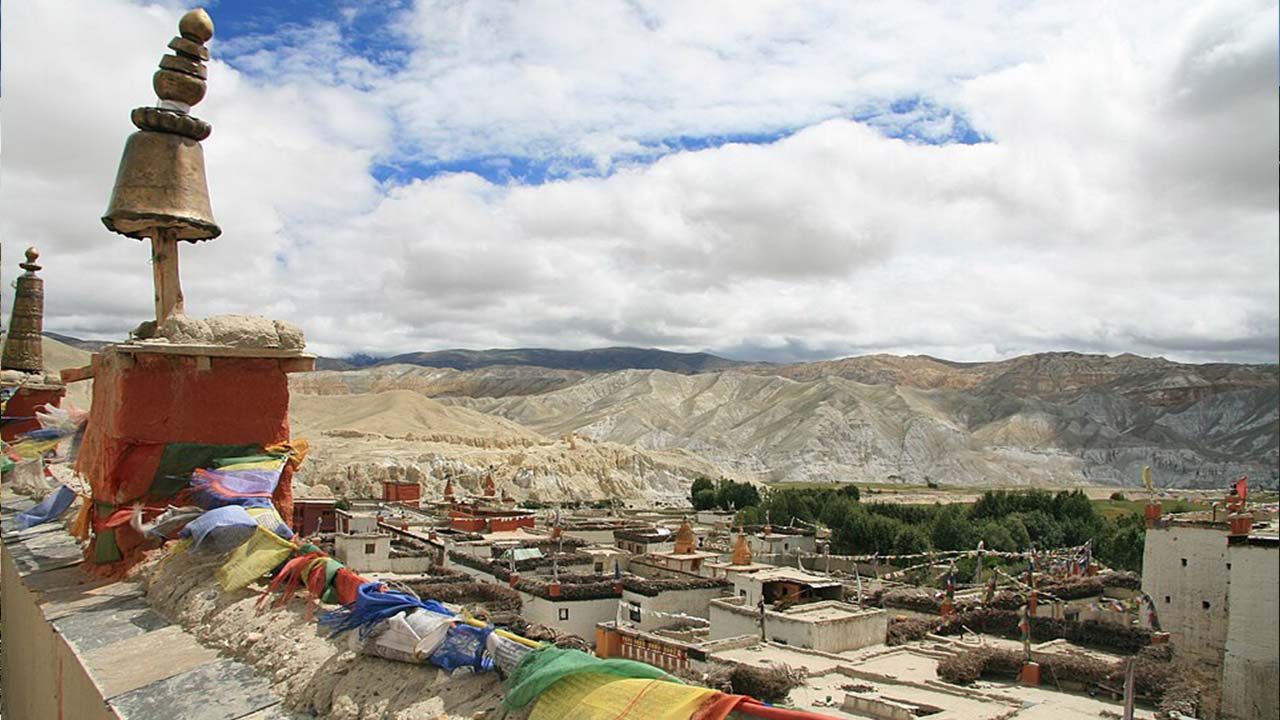
Unlike a trek where the trail simply climbs steadily toward one high destination, the Upper Mustang altitude changes through a series of ascents, descents, and high passes. The landscape also shifts noticeably with elevation, from the Kali Gandaki valley toward the dry, wind-swept Tibetan-style plateau around Lo Manthang. As you gain height, the thinner air, stronger sun, cold nights, and dry conditions can affect how your body handles long walking days.
Understanding Upper Mustang height and weather together is therefore important for planning the trek. The region's rain-shadow location keeps it considerably drier than much of Nepal during the monsoon, while winter can bring freezing temperatures and difficult conditions at higher elevations. Gradual acclimatization, sensible pacing, hydration, and appropriate clothing become increasingly important as you move above 3,000 meters.
Upper Mustang Altitude by Major Trekking Stops
The Upper Mustang Trek altitude changes considerably throughout the trek, so looking only at the elevation of Lo Manthang does not tell the full story. On the Eco Holidays Nepal route, trekkers begin at Jomsom at 2,710 meters (8,891 feet), gradually move above 3,000 meters, reach 3,800 meters at Syangbochen, and eventually arrive at Lo Manthang at 3,840 meters (12,598 feet). The route then drops and climbs again before descending toward Jomsom.
|
Trekking Stop |
Altitude |
Why It Matters |
|
Jomsom |
2,710m/ 8,891ft |
Main gateway to Upper Mustang and starting point of the trek |
|
Kagbeni |
2,804m/ 9,199ft |
Traditional entry point toward Upper Mustang |
|
Chele |
3,050m/ 10,006ft |
First major point above 3,000 meters |
|
Syangbochen |
3,800m/ 12,467ft |
One of the highest overnight stops before Lo Manthang |
|
Ghami |
3,510m/ 11,515ft |
High-altitude Mustang settlement after a significant descent |
|
Charang/Tsarang |
3,570m/ 11,712ft |
Historic Lo region settlement before Lo Manthang |
|
Lo Manthang |
3,840m/ 12,598ft |
Main destination and highest overnight elevation on this route |
The progression is not a straightforward climb from Jomsom to Lo Manthang. From Jomsom, the trail gains only 94 meters to Kagbeni before climbing another 246 meters to Chele. The most noticeable early elevation gain comes between Chele and Syangbochen, where the trail rises approximately 750 meters to 3,800 meters. From there, the route actually loses 290 meters to Ghami before making smaller gains through Charang and toward Lo Manthang.
This pattern of climbing and descending continues around the higher Mustang settlements. After reaching Lo Manthang at 3,840 meters, the route remains above 3,800 meters through Dhakmar and Syangbochen before eventually dropping to Chusang at 2,980 meters and then Jomsom. These repeated elevation changes are important because a day's physical demand depends not only on the altitude you sleep at, but also on how much you climb and descend during the day.
Upper Mustang Altitude Profile and Highest Point
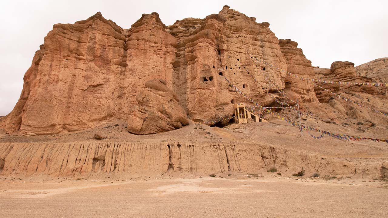
The Upper Mustang height profile is a series of climbs, descents, and high-altitude sections rather than a continuous ascent. Starting from Jomsom at 2,710 meters (8,891 feet), the trail follows the Kali Gandaki valley toward Kagbeni before climbing through Chele and the higher settlements of Mustang. The most substantial gain comes between Chele and Syangbochen, where the trail rises about 750 meters (2,460 feet) to reach 3,800 meters.
|
Route Section |
Elevation Trend |
Key Elevation Change |
Trekking Consideration |
|
Jomsom to Kagbeni |
Gradual ascent |
2,710 to 2,804 meters |
Gentle start along the lower Kali Gandaki |
|
Kagbeni to Chele |
Rising |
2,804 to 3,050 meters |
First clear move above 3,000 meters |
|
Chele to Syangbochen |
Strong ascent |
3,050 to 3,800 meters |
Biggest sustained gain; thinner air becomes more noticeable |
|
Syangbochen to Ghami |
Up and down |
3,800 to 3,510 meters |
High-altitude terrain with significant climbing and descent |
|
Ghami to Tsarang |
Moderate changes |
3,510 to 3,570 meters |
Relatively small net gain but continued walking at high elevation |
|
Tsarang to Lo Manthang |
Rising/rolling |
3,570 to 3,840 meters |
Gradual approach to the high plateau around Lo Manthang |
The route's passes and repeated climbs are important because the amount of climbing you do during a day can be much greater than the difference between your starting and ending elevations. Even when the net elevation gain is small, steep sections, descents followed by re-ascents, dry air, strong sunlight, and wind exposure can make the walking feel harder.
What Is the Highest Altitude on the Upper Mustang Trek?
On the Eco Holidays Nepal itinerary, Lo Manthang at 3,840 meters (12,598 feet) is the highest overnight elevation, but it is not necessarily the highest point your feet reach during the trek. The route crosses higher passes and viewpoints, with some sections reaching above 4,000 meters (13,123 feet). Therefore, it is useful to distinguish between three different altitude figures:
-
Highest major settlement: Lo Manthang– 3,840 meters (12,598 feet)
-
Highest overnight elevation on this itinerary: Lo Manthang– 3,840 meters
-
Highest point reached: Higher than Lo Manthang, depending on the specific route and passes included
This distinction matters because altitude affects the trek through both elevation and exposure. At around 3,800 m and above, you are walking in considerably thinner air than at Jomsom, so maintaining a steady pace and allowing time for acclimatization becomes increasingly important. The itinerary includes a rest and acclimatization day at Lo Manthang before continuing through the higher sections, helping trekkers adjust to the elevation rather than treating the trek as a simple race toward the highest point.
Upper Mustang Weather at Different Altitudes
Upper Mustang weather changes noticeably with elevation. The region lies in the rain shadow of the Annapurna and Dhaulagiri ranges, so it receives far less precipitation than southern Nepal; Nepal Tourism Board notes that Mustang receives below 300 mm of annual rainfall, compared with much higher rainfall in areas such as Pokhara. This dry climate is one reason Upper Mustang remains one of Nepal's trekking regions where the monsoon season can still be suitable for trekking.
As you climb from Jomsom at 2,710 meters to Lo Manthang at 3,840 meters, temperatures generally decrease with altitude. Nepal Tourism Board gives an average reduction of about 6°C for every 1,000 meters of elevation gain, although actual conditions vary with season, wind, sunlight, and local topography. During the daytime, the strong high-altitude sun can make exposed sections feel relatively warm, while temperatures drop quickly after sunset. The region is also characteristically windy and dry, and the combination of altitude, low humidity, and strong sunlight can make the weather feel harsher than the temperature alone suggests.
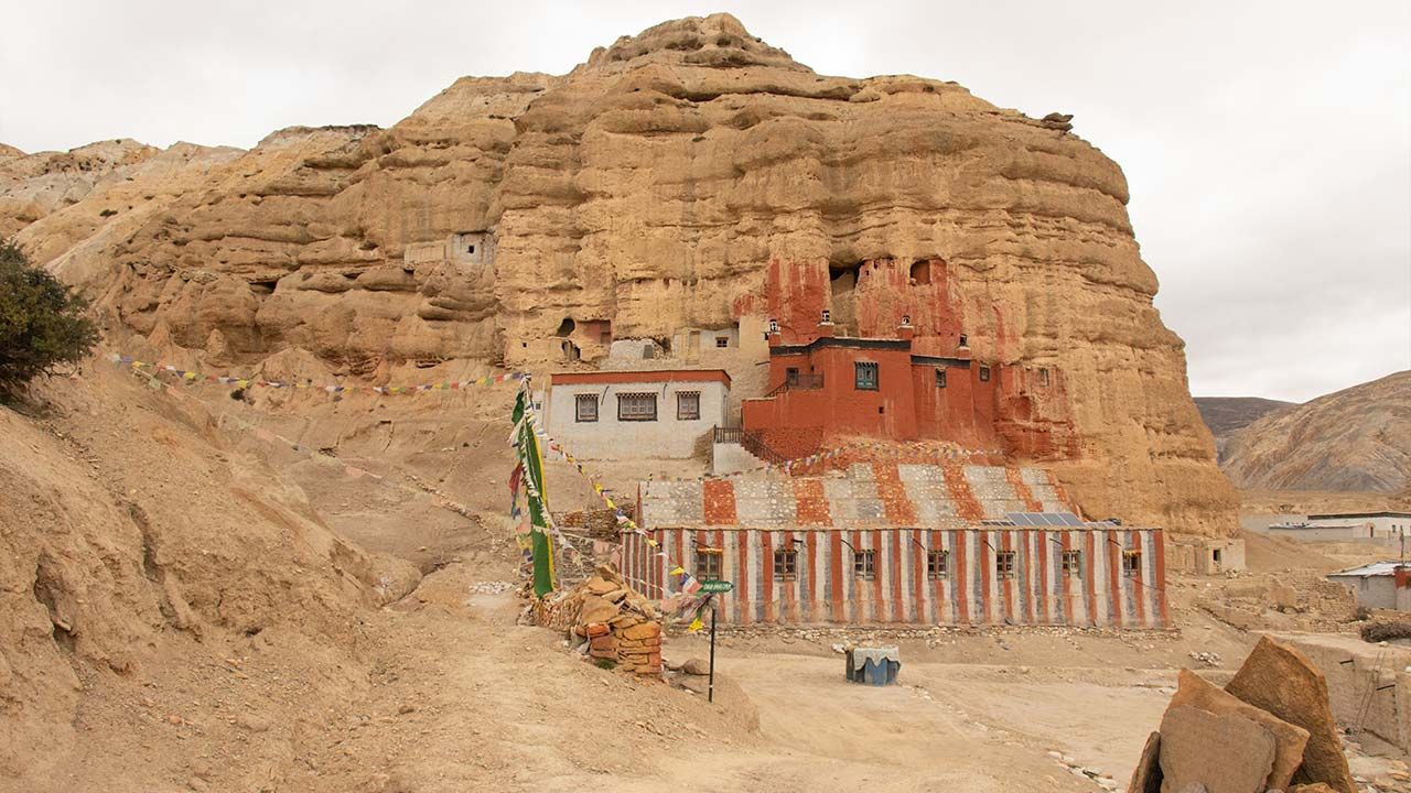
Nepal Tourism Board specifically notes that Mustang is cold in winter and windy throughout the year.
|
Season |
Typical Day Conditions |
Night Conditions |
What It Means for Trekkers |
|
Spring (March to May) |
Cool to mild, increasingly warmer |
Cold, especially above 3,500 meters |
Dry conditions with improving daytime temperatures |
|
Summer/Monsoon (June to August) |
Mild to warm, often dry |
Cool to cold |
Rain-shadow advantage; much drier than southern Nepal |
|
Autumn (September to November) |
Cool, clear and generally dry |
Cold |
Stable conditions and good mountain visibility |
|
Winter (December to February) |
Very cold, often sunny |
Freezing or below freezing at higher elevations |
Snow, strong winds, and difficult high-altitude conditions possible |
The main point is that Upper Mustang weather is strongly altitude-dependent. Lower sections around Jomsom and Kagbeni can feel considerably milder than the exposed terrain around Syangbochen and Lo Manthang. Above 3,500 meters, trekkers should be prepared for cold mornings and nights, strong winds, and rapid changes in perceived temperature. Winter is particularly demanding, with the Nepal Tourism Board advising against winter trekking in Upper Mustang because of potentially difficult weather conditions.
How Does Altitude Affect the Upper Mustang Trek?
Altitude becomes more noticeable as the Upper Mustang trek rises above 3,000 meters, particularly around Syangbochen at 3,800 m (12,467 ft) and Lo Manthang at 3,840 m (12,598 ft). As elevation increases, atmospheric pressure and available oxygen decrease, so your body has to work harder even when walking at a moderate pace. You may notice heavier breathing, a slower walking rhythm, quicker fatigue, or headaches, while sleeping can also become less comfortable at higher elevations.
The dry and exposed environment adds to the physical demand. Strong sunlight, low humidity, cold mornings and evenings, and frequent wind can increase dehydration and fatigue. Drinking regularly, eating enough, protecting yourself from the sun, and maintaining a slow, consistent pace are more useful than trying to maintain your low-altitude walking speed.
Gradual ascent is particularly important because altitude-related problems are influenced by how quickly you gain elevation, not simply how high you eventually go. The Eco Holidays Nepal itinerary allows several days to gain height and includes an acclimatization day at Lo Manthang before continuing through the higher sections. Trekkers should avoid rushing uphill, especially on the substantial 750 meters ascent from Chele to Syangbochen, and should take persistent or worsening altitude-related symptoms seriously.
Is Upper Mustang Difficult Because of Its Altitude?
The altitude is one part of the challenge, but not the only one. Upper Mustang reaches moderate-to-high trekking elevations, with overnight stays around 3,800 to 3,840 meters and route sections that rise above 4,000 m. However, the overall difficulty also comes from long walking days, repeated ascents and descents, dry and exposed terrain, and higher passes rather than from altitude alone.
For example, the route includes days of around 15 to 17 km and 6 to 7 hours of walking at high elevation, while the return from Chusang to Jomsom covers about 22 km. How demanding this feels varies with individual fitness, acclimatization, previous high-altitude experience, walking pace, and weather conditions. A trekker accustomed to long mountain days may handle the route differently from someone with little experience above 3,000 meters.
So rather than judging Upper Mustang simply as “easy” or “hard,” it is more useful to think of it as a high-altitude trek requiring steady pacing, sensible acclimatization, and preparation for long days in a dry, windy environment.
Acclimatization for Upper Mustang Altitude
Acclimatization is important on the Upper Mustang trek because the route moves from 2,710 meters (8,891 feet) at Jomsom to around 3,800 to 3,840 meters (12,467 to 12,598 feet) within several trekking days. Your body needs time to adjust to the lower oxygen availability at these elevations. The itinerary naturally provides some acclimatization as you progress through Kagbeni, Chele, Syangbochen, Ghami, and Charang rather than gaining the entire elevation in a single day.
The most important principle is gradual ascent. Avoid rushing between higher settlements, maintain a steady walking pace, stay well hydrated, and allow extra rest when your body needs it. The Eco Holidays Nepal itinerary includes a rest and acclimatization day at Lo Manthang (3,840 meters) before continuing through the higher sections. Travelers with previous altitude problems, limited high-altitude experience, or specific concerns can also consider adding an extra acclimatization day or adjusting the pace with their trekking operator.
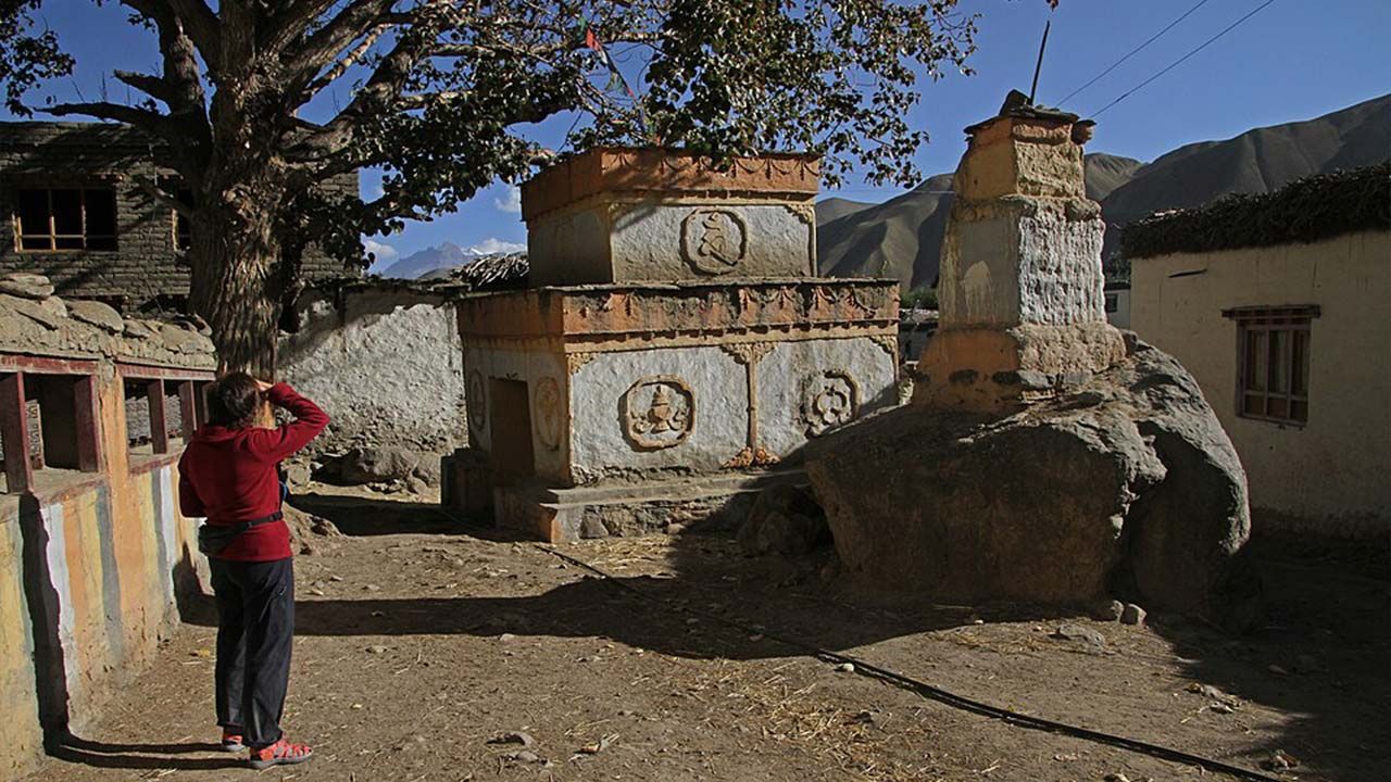
Common symptoms of altitude sickness include headache, dizziness, nausea, unusual tiredness, loss of appetite, and disturbed sleep. Mild symptoms should not simply be ignored or masked with medication so that you can continue climbing. If symptoms persist or become worse, stop ascending and inform your guide. Descent is the most important treatment when altitude illness becomes serious, particularly if symptoms suggest a more severe condition such as difficulty breathing at rest, confusion, inability to walk normally, or severe loss of coordination.
Can You Get Altitude Sickness in Upper Mustang?
Yes. Altitude sickness is possible in Upper Mustang, particularly once the trek moves above 3,000 meters and into the 3,500 to 4,000+ meter range. Reaching Syangbochen at 3,800 m and Lo Manthang at 3,840 meters means the body is exposed to substantially lower oxygen availability than at Jomsom.
Being physically fit does not eliminate the risk of altitude sickness. It can affect anyone regardless of age, fitness level, or previous trekking experience, although previous experience with altitude can help you recognize how your body responds. The safest approach is to ascend gradually, monitor symptoms, stay hydrated, and avoid pushing higher when you are already feeling unwell. If symptoms worsen despite resting, descending to a lower elevation should take priority over completing the planned itinerary.
Upper Mustang Height Compared With Other Popular Nepal Treks
Upper Mustang is a high-altitude trek, but it does not reach the same elevations as some of Nepal's classic high-altitude routes. On the Eco Holidays Nepal itinerary, Lo Manthang reaches 3,840 meters (12,598 feet), with higher passes and route sections extending above 4,000 meters. By comparison, Thorong La on the Annapurna Circuit reaches 5,416 meters, while Everest Base Camp is at 5,364 meters. The Nepal Tourism Board also describes Upper Mustang as reaching around 3,800 meters on its standard trekking route.
|
Trek |
Highest Common Elevation |
What the Elevation Means |
|
Upper Mustang |
3,840 m/ 12,598ft at Lo Manthang |
High-altitude trekking with several sections above 3,500 meters |
|
Everest Base Camp |
5,364 m/ 17,598ft |
Much higher exposure to altitude toward Gorakshep and EBC |
|
Annapurna Circuit |
5,416 m/ 17,769ft at Thorong La |
Very high pass crossing with significant altitude gain |
|
Annapurna Base Camp |
4,130 m/ 13,550ft |
High but lower than EBC and Thorong La |
|
Manaslu Circuit |
5,106 m/ 16,752ft at Larkya La |
High pass crossing and substantial altitude exposure |
|
Langtang Valley |
4,984 m/ 16,352ft on higher route sections |
High-altitude sections beyond the main valley settlements |
**Note: The 3,840 meters figure is the highest overnight elevation on the Eco Holidays Nepal route; some Upper Mustang passes and route sections are higher**
The comparison shows why Upper Mustang altitude is relatively moderate compared with EBC, Annapurna Circuit, or Manaslu Circuit, but that does not mean altitude can be ignored. The trek spends several days around 3,500 to 3,840 meters, including Syangbochen at 3,800 meters and Lo Manthang at 3,840 meters. The route also involves repeated climbs and descents, dry and exposed terrain, and higher passes. The Nepal Tourism Board notes that Upper Mustang is a high-altitude region and advises trekkers to take mountain conditions seriously.
The practical difference is therefore less about reaching an extreme maximum altitude and more about how long you spend at elevation and how quickly you gain it. A gradual ascent, steady walking pace, adequate hydration, and proper acclimatization remain important even though the Upper Mustang trek's highest overnight elevation is well below the highest points of several other major Nepal trekking routes.