
The Lukla to Everest Base Camp Trek is the classic walking route into Nepal’s Khumbu region, beginning at Lukla (2,860 m/9,383 ft) and following the Dudh Koshi Valley toward Namche Bazaar before continuing through Tengboche, Dingboche, Lobuche, and Gorak Shep to Everest Base Camp at 5,364 meters (17,598 feet). The standard route covers approximately 62 to 65 km (39 to 40 miles) one way, or around 125 to 130 km (78 to 81 miles) for the round trip, depending on the exact trail and side trips included.
Most trekkers allow 12 to 14 days for the complete Lukla to EBC to Lukla journey, including acclimatization days at key points such as Namche Bazaar and Dingboche. Although Everest Base Camp is the main destination, it is not the highest point of the trek. The trail usually reaches about 5,545 meters (18,192 feet) at Kala Patthar, a viewpoint above Gorak Shep that is commonly climbed for sunrise and panoramic views of Everest and the surrounding peaks.
The main trekking route is:
Lukla → Phakding → Namche Bazaar → Tengboche → Dingboche → Lobuche → Gorak Shep → Everest Base Camp
Trekkers can also choose helicopter options, including helicopter tours and itineraries that trek to the Everest region and return by helicopter, reducing the amount of walking on the return journey. The exact flight and landing arrangements depend on weather, operating conditions, and the itinerary chosen.
Lukla to Everest Base Camp Trek at a Glance
The Lukla to Everest Base Camp Trek combines a gradual journey from the lower Khumbu into high-altitude terrain, with the trail gaining more than 2,500 meters of elevation between Lukla and Everest Base Camp. The trek is usually planned over 12 to 14 days to allow enough time for acclimatization at Namche Bazaar and Dingboche rather than simply maximizing daily walking distance.
|
Trek Fact |
Details |
|
Starting Point |
Lukla |
|
Lukla Elevation |
2,860m/ 9,383ft |
|
Everest Base Camp Elevation |
5,364m/ 17,598ft |
|
Approx. One-Way Distance |
65 km/ 40 miles |
|
Approx. Round-Trip Distance |
130 km/ 80 miles |
|
Highest Point |
Kala Patthar |
|
Kala Patthar Elevation |
5,550m/ 18,208ft |
|
Typical Trek Duration |
12 to 14 days |
|
Average Walking Time |
5 to 7 hours per day |
|
Region |
Khumbu, Everest |
|
National Park |
Sagarmatha National Park |
The 65 km one-way distance is a useful planning figure for the classic Lukla to EBC route, but it should not be treated as a fixed measurement for every itinerary. The actual total can vary depending on the precise trail taken, accommodation points, and whether acclimatization hikes, viewpoint climbs, or other side trips are included in the calculation. The round-trip figure of around 130 km therefore represents a practical estimate rather than a universally fixed trail distance.
The altitude profile is equally important. From 2,860 meters at Lukla, the trail reaches 3,440 meters at Namche Bazaar, passes 4,410 meters at Dingboche, and eventually reaches 5,164 meters at Gorak Shep before continuing to 5,364 meters at Everest Base Camp. The trek's highest commonly reached point is Kala Patthar at around 5,550 meters, which is higher than EBC and is typically climbed as an early-morning viewpoint excursion.
Because altitude becomes increasingly significant above 3,000 meters, the 12 to 14 day duration is not simply determined by the 65 km distance. Acclimatization days and controlled daily elevation gains are built into a standard itinerary to give the body time to adjust to thinner air. This is why a relatively short daily distance can still involve several hours of demanding walking in the upper Khumbu.
Why Does the Everest Base Camp Trek Start From Lukla?
The Everest Base Camp Trek starts from Lukla because it is the most practical air-access point to the Khumbu trekking route. At 2,860 meters (9,383 feet), Lukla places trekkers directly at the southern entrance of the Everest region, allowing the standard trek to reach Namche Bazaar and the upper Khumbu within the first few days.
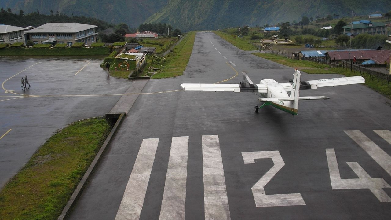
The main reasons Lukla is used as the starting point are:
-
It provides the fastest access to the Everest trekking region. Lukla is connected to Kathmandu by air, avoiding several days of overland travel and trekking through the lower Solu region.
-
It connects directly to the established Everest Base Camp trail. From Lukla, trekkers walk toward Phakding (2,610 meters) and then continue along the Dudh Koshi Valley toward Monjo and Namche Bazaar (3,440 meters) before entering the higher Khumbu.
-
It significantly reduces the approach distance. Starting from Kathmandu on foot would require a much longer approach through the lower Himalayas. The historic Jiri-to-Lukla route alone takes roughly a week of trekking before joining the conventional route from Lukla.
-
Tenzing-Hillary Airport makes Lukla an important transport gateway. The airport provides access to the remote Khumbu, where there is no road connection reaching the main Everest Base Camp trekking settlements.
-
Its elevation provides a practical starting altitude for a gradual ascent. Although Lukla is already at 2,860 meters, the standard itinerary does not immediately climb to extreme elevations. The route first passes through Phakding before ascending to Namche, allowing the trek to progress progressively toward higher elevations.
-
Lukla is the established logistics hub for the trek. Guides, porters, accommodation, food supplies, and trekking services are concentrated along the Lukla to Namche to EBC corridor, making it the established starting and finishing point for the classic itinerary.
For trekkers with more time, the Jiri or Salleri/Phaplu approaches remain alternatives. These routes add days to the journey and allow trekkers to experience the lower Solu region before joining the Khumbu trail. However, for the standard Everest Base Camp itinerary, Lukla is used because it provides the most direct access to the established high-altitude trekking route.
Lukla to Everest Base Camp Trek Route
The Lukla to Everest Base Camp Trek route follows the Dudh Koshi Valley north from Lukla before climbing progressively higher into the Khumbu toward the base of Mount Everest. The classic route passes through major Sherpa settlements including Phakding, Monjo, Namche Bazaar, Tengboche, Dingboche, Lobuche and Gorak Shep, with Everest Base Camp at 5,364 meters (17,598 feet) as the main destination.
Lukla → Phakding → Monjo → Namche Bazaar → Tengboche → Dingboche → Lobuche → Gorak Shep → Everest Base Camp
From Lukla (2,860 meters), the trail initially descends toward Phakding (2,610 meters) and then follows the Dudh Koshi River through the forested lower Khumbu. After passing Monjo (around 2,835 meters) and entering Sagarmatha National Park, the route continues to Jorsale before making the major ascent to Namche Bazaar (around 3,440 meters).
Beyond Namche, the landscape becomes increasingly alpine. The trail climbs through Kyangjuma and Sanasa toward Tengboche (3,860 meters), home to the famous Tengboche Monastery. From there, it follows the Imja Khola valley through Pangboche and Somare to Dingboche (4,410 meters). The route then crosses increasingly barren high-altitude terrain toward Dughla and Lobuche (4,910 meters).
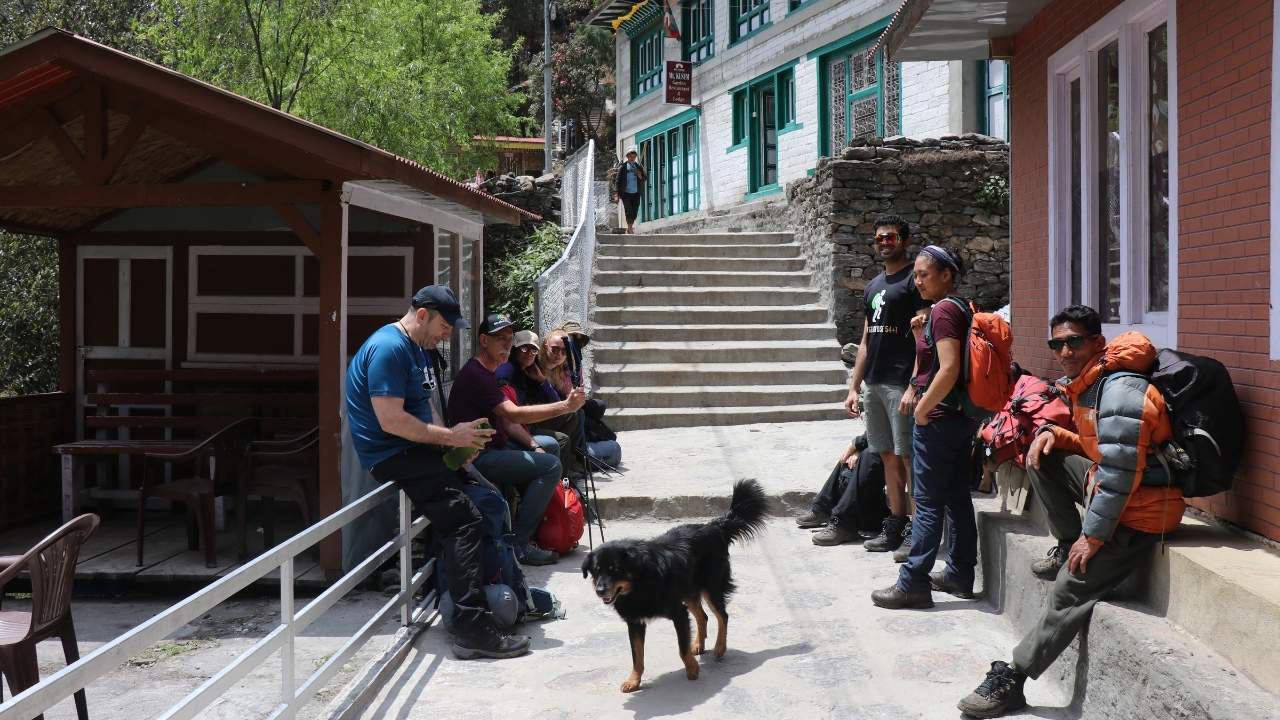
The final approach runs from Lobuche to Gorak Shep (5,164 meters) before continuing across the rocky Khumbu landscape to Everest Base Camp (5,364 meters). The trail to EBC itself does not provide a direct view of Mount Everest's summit because of the surrounding peaks, which is why Kala Patthar is commonly included near the end of the route.
Kala Patthar, at approximately 5,550 meters, is reached from Gorak Shep, usually as an early-morning climb. It is the major viewpoint of the trek, providing a much more direct panorama of Mount Everest, Nuptse, Pumori, and the surrounding Khumbu peaks. After reaching EBC and Kala Patthar, trekkers normally begin descending toward Lukla along the same general route.
Lukla to Everest Base Camp Distance
The Lukla to Everest Base Camp distance is approximately 65 km (40 miles) one way, making the classic Lukla to Everest Base Camp to Lukla trek around 130 km (81 miles) round trip. The exact distance varies slightly depending on the route measurements and whether acclimatization hikes, Kala Patthar, and other additional walks are included.
-
How Far Is Lukla to Everest Base Camp One Way?
The walking distance from Lukla (2,860 meters) to Everest Base Camp (5,364 meters) is approximately 65 km (40 miles). The route passes through Phakding, Namche Bazaar, Tengboche, Dingboche, Lobuche, and Gorak Shep before reaching EBC.
-
How Far Is the Lukla to Everest Base Camp Trek Round Trip?
The standard Lukla to Everest Base Camp and back to Lukla distance is approximately 130 km (81 miles). The actual total can be somewhat shorter or longer depending on the itinerary, route variations, and additional acclimatization or viewpoint hikes.
-
Lukla to Everest Base Camp Distance Day by Day
For the Eco Holidays Nepal 12-day itinerary, the main trekking distances are:
|
Trekking Route |
Distance |
|
Lukla → Phakding |
8km/ 4.9 miles |
|
Phakding → Namche |
12.3km/ 7.64 miles |
|
Namche → Tengboche |
10.7km/ 6.65 miles |
|
Tengboche → Dingboche |
9.8km/ 6.09 miles |
|
Dingboche → Lobuche |
8.8 km/ 5.47 miles |
|
Lobuche → Gorak Shep → EBC → Gorak Shep |
11.5km/ 7.15 miles |
|
Kala Patthar → Pheriche |
9.8km/ 6.08 miles |
|
Pheriche → Namche |
14.2km/ 8.8 miles |
|
Namche → Lukla |
17.9km/ 11.1 miles |
The Namche to Lukla return day is the longest at 17.9 km, while the Lobuche to Gorak Shep to EBC section covers 11.5 km and is one of the most significant high-altitude walking days.
**Why do distance figures differ? Published distances are not always identical because some calculations include Kala Patthar, acclimatization hikes, and other side walks, while others measure only the main trail between overnight stops. For that reason, around 65 km one way and 130 km round trip is best used as a practical overall estimate rather than an exact fixed distance**
Lukla to Everest Base Camp Elevation Gain
The Lukla to Everest Base Camp trek begins at 2,860 meters (9,383 feet) in Lukla and reaches 5,364 meters (17,598 feet) at Everest Base Camp. That gives a net elevation gain of 2,504 meters (8,215 feet) from the trek's starting point to EBC. However, this does not mean you simply walk uphill for 2,504 meters (8,215 feet). The trail repeatedly climbs, descends into valleys, and climbs again, so the actual amount of uphill walking is considerably greater.
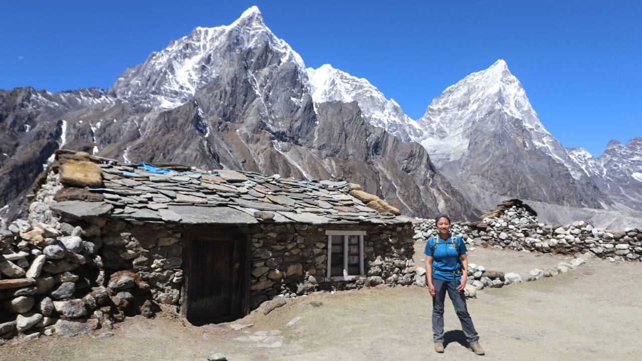
Eco Holidays Nepal's 12-day itinerary breaks the main ascent into manageable stages, with acclimatization days at Namche Bazaar (3,440 meters) and Dingboche (4,410 meters).
|
Trekking Point |
Elevation |
Change From Previous Main Point |
|
Lukla |
2,860m/ 9,383ft |
1,460m/ 4,790ft (gain) |
|
Namche Bazaar |
3,440m/ 11,286ft |
830m/ 2,723ft (gain) |
|
Tengboche |
3,867m/ 12,687ft |
427m/ 1,400ft (gain) |
|
Dingboche |
4,410m/ 14,468ft |
543m/ 1,781ft (gain) |
|
Lobuche |
4,910m/ 16,108ft |
500m/ 1,640ft (gain) |
|
Gorak Shep |
5,164m/ 16,942ft |
254m/ 833ft (gain) |
|
Everest Base Camp |
5,364m/ 17,598ft |
200m/ 656ft (gain) |
|
Kala Patthar |
5,550m/ 18,208ft |
186m/ 610ft (gain) |
The first trekking day is unusual because the route actually descends from Lukla to Phakding, dropping approximately 250 meters over 8 km. The 1,460 meters elevation figure sometimes shown for Day 1 in an itinerary refers to the difference between Kathmandu and Lukla during the flight, rather than trekking elevation gain.
Lukla to Everest Base Camp Trek Itinerary
Eco Holidays Nepal's classic 12-day Lukla to Everest Base Camp itinerary combines gradual altitude gain with two acclimatization days at Namche and Dingboche. The trek reaches Everest Base Camp at 5,364 meters (17,598 feet) and Kala Patthar at 5,550 meters (18,208 feet) before descending to Lukla.
|
Day |
Everest Base Camp Trek Itinerary |
Elevation Profile |
Duration/Distance |
|
01 |
Fly Kathmandu/Ramechhap to Lukla and trek to Phakding |
1,460m/ 4,790ft (gain) |
Flight Distance: 138km/ 85 miles Flight Duration: 35 minutes Trek Distance: 8km/ 4.9 miles Trek Duration: 3 to 4 hours |
|
02 |
Trek Phakding to Namche Bazaar |
830m/ 2,723ft (gain) |
Trek Distance: 12.3km/ 7.64 miles Duration: 5 to 6 hours |
|
03 |
Acclimatization and exploration at Namche |
||
|
04 |
Trek Namche to Tengboche |
427m/ 1,400ft (gain) |
Trek Distance: 10.7km/ 6.65 miles Duration: 5 to 6 hours |
|
05 |
Trek Tengboche to Dingboche |
543m/ 1,781ft (gain) |
Trek Distance: 9.8km/ 6.09 miles Duration: 5 to 6 hours |
|
06 |
Acclimatization at Dingboche |
||
|
07 |
Trek Dingboche to Lobuche |
500m/ 1,640ft (gain) |
Trek Distance: 8.8 km/ 5.47 miles Duration: 5 to 6 hours |
|
08 |
Trek Lobuche to Gorak Shep, Everest Base Camp, and return to Gorak Shep |
454m/ 1,489ft (gain) |
Trek Distance: 11.5km/ 7.15 miles Duration: 8 to 9 hours |
|
09 |
Sunrise hike to Kala Patthar and trek to Pheriche |
386m/ 1,266ft (gain) |
Trek Distance: 9.8km/ 6.08 miles Duration: 5 to 6 hours |
|
10 |
Trek Pheriche to Namche Bazaar |
790m/ 2,591ft (loss) |
Trek Distance: 14.2km/ 8.8 miles Duration: 5 to 6 hours |
|
11 |
Trek Namche to Lukla |
580m/ 1,902ft (loss) |
Trek Distance: 17.9km/ 11.1 miles Duration: 6 to 7 hours |
|
12 |
Fly Lukla to Kathmandu |
1,460m/ 4,790ft (loss) |
Flight Distance: 138km/ 85 miles Duration: 35 minutes |
This route covers the main Everest Base Camp trail without rushing the high-altitude section. The two acclimatization days at Namche (3,440 meters) and Dingboche (4,410 meters) are particularly important before reaching Gorak Shep, Everest Base Camp, and Kala Patthar. Trekking itineraries can also be extended to 14 days for a more gradual schedule, while helicopter-return options reduce the number of days spent descending on foot.
Lukla to Everest Base Camp Trek Map
The Lukla to Everest Base Camp trail follows the main Khumbu trekking route through Phakding, Namche Bazaar, Tengboche, Dingboche, Lobuche, and Gorak Shep before reaching Everest Base Camp at 5,364 meters (17,598 feet). The trekking route from Lukla to EBC is approximately 65 km (40 miles) one way, although the exact distance varies slightly depending on the route and side trails used.
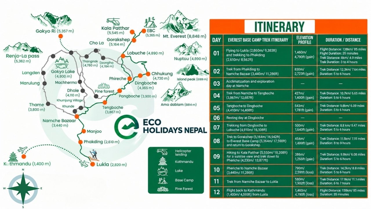
Lukla (2,860 meters) → Phakding (2,610 meters) → Namche Bazaar (3,440 meters) → Tengboche (3,867 meters) → Dingboche (4,410 meters) → Lobuche (4,910 meters) → Gorak Shep (5,164 meters) → Everest Base Camp (5,364 meters)
The first section follows the Dudh Koshi Valley, with villages, forests, suspension bridges, and river crossings dominating the landscape. The major elevation gain begins between Phakding and Namche, followed by a gradual climb through Tengboche and Dingboche. Namche and Dingboche are the main acclimatization stops on the standard itinerary.
Above Dingboche, the landscape changes noticeably as the trail leaves the greener lower valleys and enters a more exposed high-alpine environment. Vegetation becomes sparse around Lobuche and Gorak Shep, while rocky terrain, glacial landscapes, and surrounding peaks become increasingly dominant on the approach to Everest Base Camp.